Ask someone who has lived in Eastman for a season or two what "the lake trail" is, and they will describe a single thing: the loop, roughly five miles, circling the water. That answer is technically correct and practically useless, because the loop is not one trail wearing a single character the whole way around. It is four distinct stretches stitched together, each with its own terrain, its own season, and its own reason to walk it. Treat it as one uniform path and you will do what most newcomers do: walk the whole thing once, decide it's pleasant, and never think carefully about it again. Read it the way people who actually use it every week do, and a mid-August afternoon has an obvious answer.
One loop, four very different trails
Start where the Eastman Community Association's own trail descriptions start: South Cove. The stretch from South Cove to West Cove is the jogger's section. Ferns crowd the path edges and in spring the trillium comes up along the shoulder. It is a working stretch, the kind of path people use before breakfast, not the kind they linger on.
Keep going and the character changes completely. Between West Cove and the inlet on the far side of Cove Drive, the trail flattens into what the association describes as Eastman's easiest walking, a loop tight enough to circle West Cove Inlet without much elevation change at all. From there you can continue on to the dam at Mill Pond, a short detour that turns a lake walk into an errand with a destination.
The third quarter, from West Cove to North Cove, is the one built for looking rather than moving quickly. This section opens up scenic views of the lake and its three islands, crosses several small bridges over streams and wet spots, and passes a waterfall partway along the west side. It is the stretch you walk with a camera, or with someone seeing Eastman for the first time.
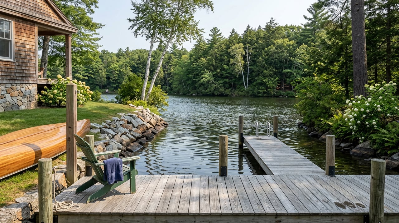
Then comes the quarter that actually matters this week. The section between North Cove and East Cove is known locally for its Pink lady's-slipper blooms, which line portions of the trail each spring. Just north of East Cove, a spur breaks off toward a spot the trail network simply calls The Rock, a swimming ledge with a view up and down the entire length of the lake.
| Loop Segment | What You'll Find | Best For |
|---|---|---|
| South Cove to West Cove | Fern-lined path, a popular jogging stretch, trillium blooms in spring | A quick out-and-back before the day starts |
| West Cove Inlet circuit | The flattest section of the whole loop, connects on to the Mill Pond dam | Dog walks, strollers, anyone short on time |
| West Cove to North Cove | Views of the lake's three islands, several footbridges, a waterfall at the midpoint | Slow walks, photos, showing the lake to a guest |
| North Cove to East Cove, plus the spur to The Rock | Pink lady's-slipper blooms in spring, a swimming ledge with views the length of the lake | Swimming and picnics, the segment worth targeting in August |
Why the east quarter earns the trip this week
Here is the part that changes how you should actually spend an August afternoon. The west side of the loop, the flattest and most convenient section, has no real swimming access. It is built for utility: a quick circuit, a dam to look at, a way to log a walk without thinking too hard about where you're going. The east side is the opposite. The spur off the North Cove to East Cove segment leads directly to The Rock, and it is the one place on the entire loop where the trail's own description calls out swimming as the point, not a side effect.
That distinction matters more in mid-August than it will in October. The lake is warm enough now to make the destination worth the walk, and the spring blooms that make the North Cove to East Cove stretch worth photographing in May have already given way to open trail and lake views by midsummer. If you are choosing one quarter of the loop to actually walk this week rather than doing the full five miles out of habit, this is the one with a reason attached to it.
The trails that never touch the lake
Eastman's Northern Trails sit apart from the lake loop entirely, and they solve a different problem: quiet, elevation, or a place to fish. The Butternut Trail starts at a kiosk at the Anderson Pond cul-de-sac and runs 1.25 miles along a route bordered by old stone walls, a leftover from when this was the North Grantham-Enfield Center Highway. It passes a turnoff to Anderson Pond, meets the Stroing Brook Trail partway along, and eventually drops to an overlook above Butternut Pond that longtime users treat as a picnic spot with a view rather than a destination in itself.
Cole Pond Trail is the harder option, 1.7 miles rated strenuous, starting from a trailhead at the end of Hilltop Place and climbing a service road before reaching a rock ledge high above Eastman Lake. From there it follows the stone wall marking the Grantham-Enfield boundary down to Cole Pond, which is stocked with trout. A short 0.15-mile spur off the main trail leads past a set of caves to a chimney site that has become the spot locals treat as a second swimming hole, quieter and less obvious than The Rock. The Stroing Brook Trail, at eight tenths of a mile, is the connector that ties Butternut and Cole Pond together if you want to link the two into a longer loop.
The flat option, when you need one
Not every walk needs to be a workout or a swim. John's Glen Trail, numbered nine on the association's map, offers level walking with a few optional loops built in and a yurt with toilets roughly midway. It is the trail to suggest when you're walking with an older relative, a young child, or a guest who wants to see the woods without committing to elevation. Access runs off Clearwater Drive: from the circle at Eastman's main entrance, head 0.8 miles up Eastman Road, bear right onto Road 'Round the Lake, turn right onto Clearwater Drive after 0.3 miles, and the trailhead parking sits at the end, 0.9 miles further in.
If elevation is actually what you're after, the lake loop will disappoint you. The full 5.1-mile circuit gains only about 170 feet over its entire length, according to AllTrails' trail data, which tells you how gentle the whole thing really is. Prospect Hill, by contrast, climbs 708 feet, the most of any trail in the area, and Little Mt Washington isn't far behind at 429 feet and carries the area's only dedicated running-trail rating, at 4.1 stars across more than a hundred community reviews. Those two are worth knowing about precisely because the lake loop cannot deliver what they do.
Before you go
Every trail in this network, lake loop included, is owned by the Eastman Community Association and kept up by the association's staff along with community volunteers, which is part of why the trail markings and signage stay as reliable as they do season after season. Trails are open dawn to dusk. Dogs are welcome on leash through spring, summer, and fall, but are not permitted on the groomed cross-country ski trails once winter grooming begins.
If you're bringing a guest who isn't a resident, they will need a parking pass, which is free but requires a stop first. From I-89 Exit 13, head north on Route 10, turn right at Eastman's main entrance, follow the circle 0.2 miles, bear right onto Greensward Drive, and continue 0.4 miles to Clubhouse Lane on the left, where The Center issues the pass. From there, return to the circle, turn onto Eastman Road, and follow the directions to whichever trailhead you're headed for.
None of this requires a map with pins on it so much as a habit of matching the segment to the errand. A jog before work belongs on the South Cove to West Cove stretch. A dog walk with fifteen minutes to spare belongs on the West Cove flat circuit. A guest who wants to see the lake belongs on the West Cove to North Cove stretch, where the three islands and the waterfall do the work for you. And right now, in the middle of August, the walk worth making on purpose is the one that ends at The Rock.
If you're weighing a move to Grantham or the wider Lake Sunapee and Upper Valley region and want a sense of how a place like Eastman actually lives day to day, not just how it photographs, Andy Clouse has spent years working these towns from the inside. Let's Connect.