Pricing rural acreage in Grantham or Sullivan can feel tricky. One parcel looks like a deal until you learn most of it is wet, or the only access is by a seasonal road. You want a clear, local way to judge value before you list or make an offer. This guide gives you a practical framework that fits how buyers and appraisers actually evaluate land in Sullivan County. Let’s dive in.
What drives value locally
Buildable vs. gross acres
Many listings quote gross acreage. What matters most is how much you can actually use. Wetlands, steep slopes, ledge, buffers, and rights of way cut into usable area. Plan to verify with wetland delineation, perc testing, and a site survey to define a realistic building envelope.
Access and frontage
Buyers place a premium on frontage on a town maintained road. Private and seasonal roads can limit financing and increase maintenance costs. If access is by easement or a shared drive, get the agreement and costs in writing. Clear legal access helps price and marketability.
Soils, septic, and water
Your septic option and bedroom count hinge on soils and perc results. Poorly draining soils or shallow ledge raise costs or limit build size. Most parcels require a private well, so factor in well feasibility and likely drilling depths. Confirm with licensed septic designers and well drillers who work in this area.
Topography and drainage
Steep slopes and challenging grades reduce the buildable footprint and drive up site work. Long driveways need more clearing, gravel, and culverts. Good natural drainage and moderate slopes improve feasibility and value.
Wetlands and floodplain
Mapped wetlands and required buffers can rule out building in large portions of a lot. Floodplain status can require special construction and insurance. A certified wetland scientist and a review of flood maps help you avoid surprises.
Easements and restrictions
Conservation easements, deed covenants, and rights of way shape what you can do with the land. Some parcels are conserved in full or in part, which limits development and often reduces market value for building. These same features may appeal to buyers who value recreation and privacy.
Timber and agricultural potential
Merchantable timber can add value, but it depends on species, access, and allowed harvesting. Productive soils and gentle slopes can support small scale agriculture. Confirm any income angle with a forester or agricultural professional.
Views, privacy, and recreation
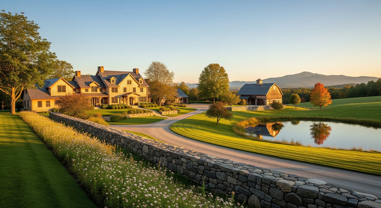
Long range views, water features, and proximity to trails can create a price premium. Scenic qualities and privacy are strong motivators for rural buyers in the Lake Sunapee and Upper Valley region.
Zoning and subdivision rules
Minimum lot size, frontage, and setbacks vary by town. Overlay districts, shoreland protections, and aquifer rules can apply. If subdivision is possible, your pricing should reflect realistic yield, not just gross acres.
Market access and demand
Distance to services, commute routes, and seasonal dynamics influence the buyer pool. Parcels closer to highways, jobs, and shopping typically draw more interest and higher offers.
A step by step pricing framework
- Establish usable acres
- Walk the land if possible and review soils, wetlands, slope, and access.
- Order a recent survey, wetland delineation, and perc test if you want maximum pricing confidence.
- Gather comps
- Pull recent sales and active listings for similar parcels in Grantham, Sullivan, and adjacent towns.
- Match for size range, access type, utilities, and constraints.
- Adjust for differences
- Convert comparables to a common basis, such as price per usable acre or price per potential building lot.
- Adjust for frontage, road type, utility proximity, septic feasibility, views, and any easements.
- Estimate site development costs
- Model typical costs to create a finished lot: clearing, driveway, septic, well, utility extension, and permits.
- Long driveways, steep grades, ledge, and poor soils increase cost and reduce land value.
- Set your price with a rationale
- Present both gross and usable acre numbers with clear assumptions.
- If comps are thin, blend sales comparison with a cost to develop outlook and, if relevant, a residual analysis for subdivision potential.
Simple templates you can use
Usable Acres = Gross Acres − (Wetlands + Steep Slope Areas + Required Buffers + Rights of Way)
Adjusted Comparable Price = Sale Price × (1 + Sum of Adjustments) Adjustments reflect usable acres, access, utilities, views, and restrictions.
Residual Land Value = Projected Lot Sales Revenue − (Development Costs + Developer Profit)
Use these only with documented assumptions. Note whether usable acres are estimated or professionally verified.
Pick the right valuation method
Sales comparison approach
This is the most common method. Find recent sales of similar rural parcels, then normalize to price per usable acre or per potential lot. Make clear adjustments for access, utilities, septic feasibility, and constraints. When large parcels lack close comps, expand to nearby towns and explain your geographic adjustment.
Cost or site development approach
If buyers will focus on what it costs to create a finished house lot, start with the market value of a typical finished lot. Subtract the cost to get from raw land to finished lot, including survey, permits, clearing, driveway, septic, well, utilities, and a developer margin. The result guides a realistic raw land price.
Income approach
Use this if the land can produce income from timber, agriculture, hunting access, or a lease. A timber cruise and local stumpage rates can inform value on wooded tracts. Income is often a small share of total value, but it matters for investment minded buyers.
Highest and best use analysis
Confirm that your intended use is legally allowed, physically possible, financially feasible, and maximally productive. If subdivision is realistic, price to a defended lot yield rather than a simple per acre figure. Document zoning, septic layout potential, wetland buffers, and road requirements.
Tests, permits, and costs that change price
- Boundary and site survey to confirm acreage, rights of way, and buildable envelope.
- Wetland delineation to map constrained areas and support any required permits.
- Perc test and septic design to define bedroom count and system type.
- Well feasibility and any available well logs to guide expectations.
- Soil test pits to confirm or refine NRCS soil map indicators.
- Driveway permits and culvert rules for safe access to a town road.
- Shoreland or stream buffer permits if water features are present.
- Easement and restriction search at the County Registry of Deeds.
- Local quotes for driveway construction and maintenance, septic installation, well drilling, clearing and stump removal, grading, erosion control, and utility hookups.
Negative results from these steps are common reasons for price cuts or failed deals, so build them into your pricing plan.
New Hampshire rules to review
- Town zoning and subdivision regulations for minimum lot size, frontage, and setbacks.
- State wetlands and shoreland protections that trigger New Hampshire Department of Environmental Services review.
- Septic rules that tie bedroom counts to system design.
- Current use classification under RSA 79 A, which lowers assessed value for qualifying agricultural and forest land. Be aware that changing use can trigger rollback taxes.
- Property taxes and assessments that may differ from market value. The town assessor and Department of Revenue Administration guidance explain methodology.
- Private road obligations and associations that can add costs and affect buyer appeal.
Local records and resources
- Town Offices in Grantham and Sullivan, including the assessor, planning board, and building or zoning staff.
- Northern New England MLS for closed and active rural acreage sales.
- New Hampshire Department of Environmental Services for wetlands, shoreland, and septic guidance.
- USDA NRCS Web Soil Survey for soil types and septic suitability indicators.
- NH GRANIT for parcel, elevation, land cover, and hydrology context.
- FEMA flood maps for floodplain status.
- County Registry of Deeds for deeds, easements, covenants, and conservation restrictions.
- Local conservation commissions and regional land trusts for conserved parcel mapping.
Seller checklist before you list
- Order a recent boundary survey or confirm a reliable existing one.
- Complete a perc test and a preliminary septic design where feasible.
- Hire a certified wetland scientist for delineation if wetlands are likely.
- Clear a modest building site and safe access path for photos and showings.
- Pull deed, easements, and any conservation documents from the Registry of Deeds.
- Gather tax bills, assessed value, and any current use documentation.
- Consult an experienced Sullivan County land appraiser or agent to align on price, comps, and adjustments.
These steps reduce buyer uncertainty and support a stronger list price. Weigh the upfront cost against expected return.
Buyer due diligence checklist
- Make your offer contingent on survey, perc, and wetland delineation.
- Confirm legal access, road maintenance terms, and any association fees.
- Review zoning, minimum lot size, and setback requirements for your intended use.
- Obtain rough quotes for driveway, septic, well, clearing, grading, and utility extension.
- Check floodplain status and shoreland or stream buffers if water is nearby.
- Verify any conservation easements or deed restrictions.
Listing strategy that works here
- Present both gross and usable acres in your listing with clear notes on what is verified versus estimated.
- Call out access type, utility proximity, perc or septic status, and any wetlands or easements.
- Use professional media to showcase the building area, access, and key features like views or water.
- When comps are scarce, show your blended method. Include a simple explanation of comparable adjustments and cost to prepare.
- For large tracts, consider staged marketing to individual buyers, small builders, and conservation interests, depending on the parcel’s potential.
Common cost drivers to model
- Driveway length, slope, and need for culverts.
- Septic system type and bedroom capacity based on soils.
- Well depth and distance to utilities along the road.
- Clearing, stump removal, ledge excavation, and erosion control.
- Permitting timelines and any special studies required.
A realistic cost model strengthens your negotiating position and aligns expectations inside your pricing range.
Set a confident list price
The strongest pricing in Grantham and Sullivan is specific, not generic. Start with usable acres, not gross. Show your comps, your adjustments, and your cost to prepare outlook. If subdivision potential applies, back up your yield with zoning and site constraints. Then list with a clear story that answers buyers’ questions before they ask.
If you want a seasoned local partner to walk this process with you, connect with Andy Clouse. You will get disciplined pricing guidance, premium presentation, and responsive coordination from start to finish.
FAQs
How should I compare price per acre for Grantham land?
- Use price per buildable or usable acre whenever possible. Gross acreage can be misleading if wetlands, steep slopes, or buffers limit where you can build.
What does a perc test tell me on Sullivan parcels?
- A perc test measures how soil absorbs water, which guides septic design and bedroom count. Poor results can require a costlier system or reduce allowable bedrooms.
How do wetlands or conservation easements affect value?
- Wetlands reduce buildable area and may require permits. Conservation easements limit development rights, which typically lowers value for building but can appeal to recreation focused buyers.
What if there are few comparable sales nearby?
- Blend methods. Use sales comparison with clear adjustments, add a cost to develop view, and run a residual analysis if subdivision is realistic. Document all assumptions.
Can timber help offset my purchase price?
- Possibly. Have a forester perform a timber cruise and apply local stumpage rates. Timber value is often modest but can be material on well stocked tracts with good access.
Who usually pays for surveys and testing on rural land?
- It is negotiable. Sellers must provide clear title and disclosures. Buyers commonly pay for survey, perc, and wetland work as contingencies unless the seller agrees to share costs.
How do New Hampshire taxes and current use impact my decision?
- Current use classification can lower assessed value and taxes for qualifying land. Building or subdividing can trigger rollback taxes, so review status with the town assessor before you decide.