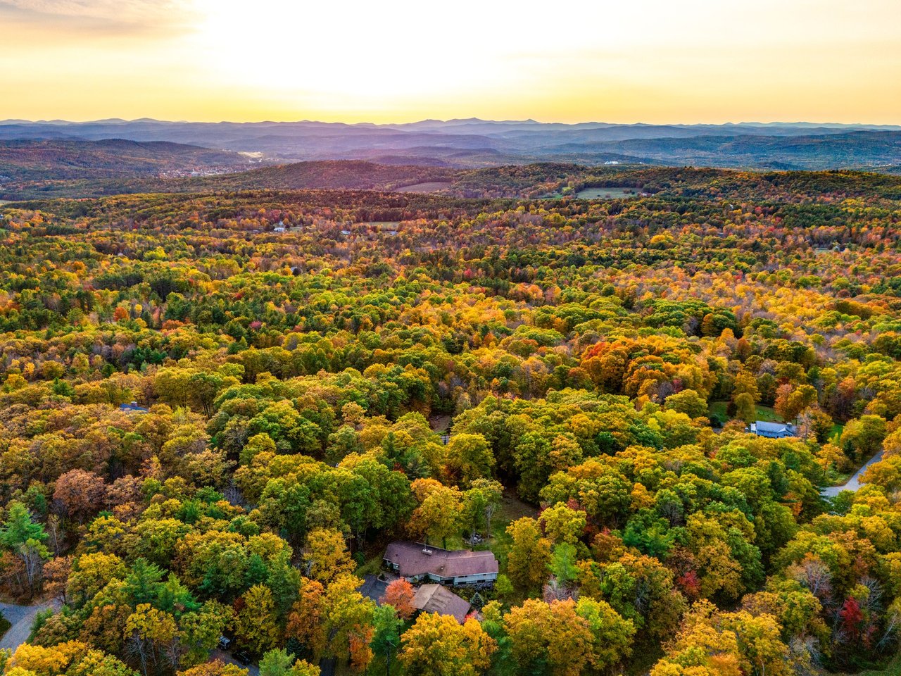
Buying land with room to breathe sounds simple until zoning rules, road access, and septic approvals enter the picture. If you’re eyeing acreage in Grantham, you want a clear plan that helps you act with confidence and avoid costly surprises. This guide gives you a practical sequence to follow, the key rules to know, and the exact town and state resources to use. You’ll walk away with a checklist you can bring to your agent, the town, and your consultants. Let’s dive in.
Start with zoning and overlays
Your first task is to confirm the parcel’s zoning district and any overlays. The town’s Zoning Ordinance and official Zoning Map define minimum lot size, frontage, setbacks, and where you can build. Begin by reviewing the district rules in the current Grantham Zoning Ordinance and locating the property on the Zoning Map.
In Grantham’s rural areas, you’ll most often see Rural Residential districts and the Forest Lands Conservation District. The Forest Lands Conservation District is the most restrictive in the ordinance, with a minimum lot area of 50 acres and 1,000 feet of frontage. If land lies in that district, permitted uses are tightly limited, so confirm district boundaries early in your review.
Pay close attention to what counts toward “minimum lot area.” The ordinance explains that wetlands, water bodies, and slopes greater than 20 percent are generally excluded from minimum area calculations. This means a parcel that looks large on paper may not have enough buildable land for your plans.
The ordinance also provides for cluster-style housing in some cases, which can allow smaller home sites within a larger tract while preserving open space. If you’re exploring multiple homesites or shared systems, read the cluster provisions in the Zoning Ordinance and speak with the Planning Board. Setbacks, coverage, and height limits vary by district, and Shoreland and Flood Plain overlays add state-run restrictions near certain water bodies.
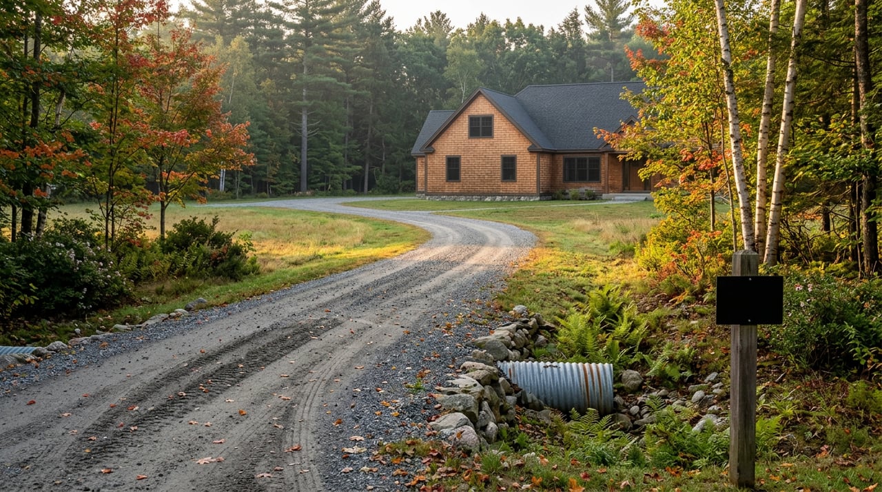
Confirm access and driveway early
Access can determine whether you can build at all. Grantham requires a driveway permit before a building permit will be issued. The town’s Driveway Regulations outline sight-distance expectations, culvert needs, and surfacing at the road. A key example in the regulations is a 150-foot minimum sight distance in both directions from a point 10 feet outside the road shoulder.
If your frontage is on a Class VI (unmaintained) or a private road, expect extra steps. The town has a written procedure for building on Class VI roads that can include road improvement plans, bonds, hearings, and required filings, and it clearly states the town does not assume maintenance for improvements made. Review the town’s Class VI policy and be ready for additional cost and planning if your frontage is not on a maintained town road. You can find the procedure in the town’s Class VI road building materials.
Utilities, water, and community systems
Electric service in Grantham is delivered over the Eversource distribution network. Grantham Community Power affects supply choice, but Eversource still delivers electricity. If service capacity or underground vs. overhead matters to you, confirm availability and service point logistics with the utility and your contractor, and review the town’s Community Power plan for context.
Most acreage parcels rely on private wells and on-site septic systems. Some neighborhoods, notably areas in Eastman and the Village District of Eastman, use community water and sewer. To confirm what serves a specific parcel, start with the town’s tax card and mapping tools on the Assessing & GIS portal. Look for notes such as “Water Source: Community” or “Private.”
Septic and well due diligence
Septic systems in New Hampshire are governed by NHDES rules (Env-Wq 1000). Grantham’s ordinance references these standards and adds local minimum separations. For example, septic components must be a minimum of 75 feet from a well or the edge of a public water body. Plan to hire a permitted designer to conduct test pits and percolation testing and to prepare a system design that meets Env-Wq 1000.
For wells, order any available well records and have a licensed well professional evaluate yield and water quality when feasible. Private wells are not regulated like public systems, so you own the testing and risk management. In many rural purchases, the availability of a suitable septic footprint and a reliable well are the single most important constraints, so move this work to the front of your schedule.
Current Use, conservation, and taxes
New Hampshire’s Current Use program can reduce property taxes for qualifying open land. If you remove land from Current Use, a one-time Land Use Change Tax applies. State law sets that tax at 10 percent of the full and true value of the portion that changes use. Review the statute for details in RSA 79-A:7.
Ask the town assessor whether any part of the parcel is enrolled in Current Use and request related forms or maps. The Assessing & GIS portal is a good first stop to view tax cards and parcel notes. Also, verify any conservation easements, deed restrictions, or rights-of-way at the Sullivan County Registry of Deeds. Easements can limit building, subdivision, or timbering regardless of what you see on site.
Step-by-step due diligence plan
Use this sequence to organize your work and keep momentum:
- Zoning and overlays
- Identify the parcel’s district on the Zoning Map and read the relevant district rules in the Zoning Ordinance.
- Note any Shoreland or Flood Plain overlays and plan to contact NHDES if you are near protected water.
- Current Use and assessor checks
- Ask the assessor if any portion is enrolled in Current Use and whether any prior withdrawals occurred. Use the Assessing & GIS portal to pull the tax card and any posted maps.
- Access and driveway
- Confirm whether frontage is on a maintained town road, a Class VI road, or a private road. Review the town’s Driveway Regulations and, if needed, the Class VI road procedure. Identify the most likely driveway location with safe sight lines and apply early.
- Septic and well suitability
- Hire a permitted ISDS designer to perform test pits and percolation testing and to confirm system sizing under Env-Wq 1000.
- Order available well logs and arrange for yield and water-quality testing.
- Title and easements
- Ask a local real estate attorney to search title for conservation easements, rights-of-way, or deed restrictions that limit development or access.
- Site layout and build envelope
- Engage a licensed surveyor to mark boundaries and model setbacks, slopes, and wetlands to confirm a viable building envelope.
- Plan approvals and schedule
- Map out town and NHDES applications you will need. The town’s Permits & Forms page lists local applications and Planning Board materials. For work in or near wetlands, review NHDES guidance under RSA 482-A.
Permits and approvals to expect
Depending on your project, you may encounter some or all of the following:
- Driveway permit from the town. An approved driveway permit must be on file before a building permit is issued.
- Building permit from the town.
- Septic system approval from NHDES per Env-Wq 1000.
- Shoreland permit from NHDES if your project lies within 250 feet of a protected waterbody.
- Wetlands or Fill and Dredge permit from NHDES under RSA 482-A if you work in or adjacent to wetlands.
- Planning Board approvals for subdivisions, cluster developments, or road work. Check the town’s Permits & Forms for applications and fee schedules.
Budget and timeline basics
Set realistic timelines for each phase. Early desktop checks with the zoning map, tax card, and assessor typically take a few days. Site investigations like survey work, soil test pits, and well testing can take a few weeks and depend on weather and access.
Permitting timelines vary with complexity. Driveway, building, septic, wetlands, and shoreland submissions can run from several weeks to a few months. Add time for Planning Board cycles, required public notices, and any state reviews. If your land fronts a Class VI or private road, build in extra time for engineering, bonding, and hearings.
Quick red flags to pause and verify
Use this list to spot issues that warrant a deeper look before you proceed:
- No recorded deeded access to a public way.
- Large areas of wetlands or slopes over 20 percent that reduce usable acreage.
- Frontage on a Class VI or private road without a maintenance agreement, or where driveway sight distances cannot meet town standards.
- Land enrolled in Current Use where you plan to carve new lots or add homes, creating Land Use Change Tax exposure.
- No record of an NHDES-approved septic design where you intend to build.
Questions to ask your team
Bring these to your agent, the town, and your consultants so you get crisp answers:
- What is the parcel’s zoning district and are any changes pending?
- Is any portion in Current Use, and if so, how many acres and on which map/lot?
- Does the tax card show a permitted septic or existing well, and are NHDES records available?
- Is frontage on a Class V town road, a Class VI road, or a private road, and who maintains it?
- Where will the Road Agent likely approve a driveway that meets sight-distance rules?
- Are there wetlands or shoreland constraints that will trigger NHDES permits or mitigation?
- Do recorded easements, restrictions, or rights-of-way limit building or access?
- What electric service capacity and service point are available at the proposed homesite, and how does Community Power affect supply choices?
- What Planning Board fees and meeting cycles apply to your approvals?
- If you plan to timber, what BMPs and forester plan requirements apply under the ordinance?
Work with a local strategist
Buying acreage is part vision and part process. When you sequence zoning checks, driveway approvals, septic and well testing, and title research the right way, you reduce risk and keep your build plan on track. If you want a local, disciplined approach to due diligence, scheduling, and negotiation, reach out to Andy Clouse. You’ll get town-level guidance, clear next steps, and a calm path from offer to closing.
FAQs
What should I check first when buying land in Grantham?
- Start with the parcel’s zoning district on the official Zoning Map, read the Zoning Ordinance for minimums and overlays, and confirm access conditions and driveway feasibility.
How do Class VI or private roads affect my build?
- Building off a Class VI or private road often requires extra plans, bonds, and filings, and the town does not assume maintenance for improvements, so expect added cost and time.
Do I need a driveway permit before a building permit?
- Yes. Grantham requires an approved driveway permit on file before issuing a building permit, so apply early and confirm sight distances and culvert needs.
What is the Land Use Change Tax if land is in Current Use?
- When land is removed from Current Use, the Land Use Change Tax equals 10 percent of the full and true value of the portion that changes use under RSA 79-A:7.
How soon should I schedule septic and well tests?
- As early as possible. Soil testing and well evaluation often determine if a site is feasible and can take weeks depending on access and weather.